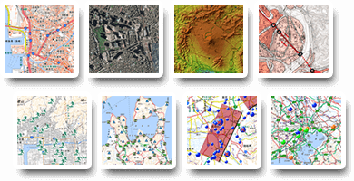
地理院地図で見ることのできる
地図や写真一覧
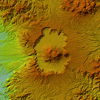
標高・土地の凹凸
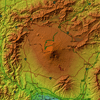 |
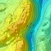
標高に応じて色分けした地図です。広い範囲を起伏を理解するのに適しています。 |
 |
自由に色分けできる標高地図です。低地の細かい標高の変化もよくわかります。 |
 |
デジタル標高地形図
-
北海道
-
東北
-
関東
-
北陸
-
中部
-
近畿
-
中国
-
四国
-
九州・沖縄
標高に応じて色分けした地域ごとの地図です。各地域特有の地形がよくわかります。
|
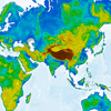 |
標高に応じて色分けした世界地図です。地球地図全球版標高第2版データから算出しています。 |
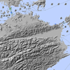 |
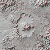
陰影を付けた白黒の地図です。地表面の凹凸がよくわかります。 |
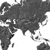 |
陰影を付けた白黒の世界地図です。地表面の凹凸がよくわかります。 |
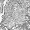 |
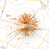
地表面の傾きを示した地図です。白いほど緩やか、黒いほど急峻であることを意味しています。 |
 |
地表面の傾きを区分した地図です。一般的に雪崩は一定の傾斜の斜面で発生しやすいことが知られていますが、雪崩の危険度を評価したものではありませんのでご注意下さい。 |
 |
3Dメガネ(赤青めがね)を通すと立体的に見える地図です(カラー)。 |
 |
3Dメガネ(赤青めがね)を通すと立体的に見える地図です(グレー)。 |
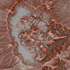 |
地形の起伏を赤色の濃淡で表した地図で、微地形を把握するのに適しています。 |
 |
|
ページトップへ
Copyright. Geospatial Information Authority of Japan. ALL RIGHTS RESERVED.

